Show us why the public should always call a land surveyor

Where are you surveying?

All Posts (617)

Sort by

help with Civil 3D and importing Lat and Long points

I need help. Can any one guide me on importing points collected from a GPS unit.What format should my Excel file be in or should I use a .txt file? Right now my Excel file is a .CSV and it only has 3 columns: point number, latitude, longitude looks like: 2 45.33353745 -122.7635515Also how to set up the import Point File format in Civil 3D?What should the drawing settings be as far as the zone and available coordinate system?Thanks
Read more…
GEO Ambassador
I just ran across an article on Mashable about the first astronauts to send a twitter update from outer space and it got me to thinking more about our Field Support Group here on LSU. I've come to the conclusion that If Astronauts Can Tweet from Space, Surveyors Can Tweet from the Woods! If you are interested in becoming part of this experimental group which I have been masterminding, which will enable networked land surveyors to use Twitter and Google Wave to assist one another with real-time t
Read more…
GEO Ambassador
This is part One of a series of blog posts regarding land surveying resources and links for our LSU members-this one is all about land surveying schools and certifications. If you have a resource or link that I missed, please feel free to drop it in the comments below the post so that everyone may benefit from this resource. LAND SURVEYING SCHOOLS, COLLEGES AND TRAINING http://www.cinstate.cc.oh.us Cincinnati State Technical & Community College - Engineering Technologies http://www.etsu.edu/scit
Read more…
GEO Ambassador
Below you will find a few pieces of software that I've run across and thought could be helpful to our land surveying members. They're all free! Comment if you have any questions whatsoever.mapinfo.JPG
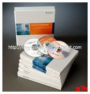
MapInfo Professional 10 FULLMapinfo Professional 10 Full | Mirror MediafireMapInfo Professional is a powerful Microsoft Windows-based mapping and geographic analysis application from the experts in location intelligence. Designed to easily visualize the relationships between data and geography, MapInfo Profess
Read more…

A Couple of GPS Hacks via Software

Here are a couple of GPS hacks that I ran across via and thought might be useful if not just interesting to the group. The first is a location based browser plug-in called Geode, by Mozilla. Geode will let users to take advantage of location data embedded within a web page. Geode’s uses Skyhook’s Loki technology, which determines position base on what WiFi access points it sees just like the Eye-Fi.

Geode

Download & Try It OutYou can download Geode here.The second comes from Hackaday as well. Its calle
Read more…
Popular Mechanics has a detailed how-to on diy ruggedization of common portable electronics such as laptops, cameras, and cellphones. There is video of a laptop surviving an eight foot fall due to the tennis balls, pipe insulation, and weather stripping they’ve added. Its not just shock resistant, they’ve used a two-part compound marketed for making custom molded earplugs to make the laptop water resistant.

rugged laptop

[via source]
Read more…

Annoying zoom extents?

In AutoCAD 2000i LDD when double clicking the mouse too quickly the drawing does a zoom extents. For example I have a three-button mouse, the center button (the mouse wheel) being the culprit, it controls the zooming and panning. Well I will be flying around in the drawing, zoomed in to some degree and then it happens; zoom extents!I think I found a fix to this problem by typing in at the command prompt: "viewres" and hit enter, you are then prompted with the question "Do you want fast zooms?" b
Read more…
Views: 104
Thoughts: 1
GEO Ambassador
Greetings Surveyors,Today I introduce to you our newest member of the LSU Network, Land Surveyor United (Admin), Justin Farrow. Justin is the creator and founder of LSU and has decided to make his profile the exclusive go-to for any questions, concerns, suggestions etc. regarding the network. I ask that ALL MEMBERS please go to this new LSU (Admin) profile and click on the "Add as Friend" link under his profile image.There are a lot of exciting changes about to occur with LSU, including an offic
Read more…
GEO Ambassador
I've been meaning to make this post for quite sometime , so with the new year on the horizon i figured it is about time to explain how to customize your LSU profile so that we can all start off with a fresh look. This should take no more than 5-10 minutes and when you're finished, you'll have a more unique profile page, ready to represent you, your company or location for other surveyors across the world to admire.First, log in (if you haven't already) and click on the tab that says "My Page" in
Read more…
GEO Ambassador

Google Wave Invites for LSU Members

Happy Holidays Surveyors!Just wanted to mention that there are a few Google Wave invitations available if any of you are in need of one. logo_preview.png I have 25 available so here's the deal: Kindly drop a comment under this post with a simple statement about your opinion of Land Surveyors United and how you think it is changing the way surveyors communicate and I'll send the invitation right out to you.If you are Already On Google WaveIf you are already on Google Wave, drop your wave id below if you like and
Read more…

6 weeks in the swamp ...

We've finally finished 6 weeks of cutting line in the central Florida swamps for a 100+ acre tract that had almost no open areas. I've been unemployed for 6 months when an old employer called me up and offered me a field position again ... I've been getting soft in the office as a manager for about 5-6 years and he wanted me to head a crew up and go line-cutting. I needed the money badly and jumped on the chance to get back out into the field with gusto. Man how 5 years of sitting on your butt c
Read more…
Well, Jaime, Susan & I made it back to the warmth and safety of our Corpus Christi digs on October 3rd.This years Alaska adventure was like none other. I've lived and worked in the "Last Frontier" for almost twenty years now and this season we got to go to places I've never even heard of much less seen.We arrived at our base camp in Nome the last week of May. We could have postponed that a few weeks as there was still 3 to 4 feet of snow still standing on the ground on arrival. Norton Sound was
Read more…
GEO Ambassador
We just posted a huge list of land surveying and construction equipment Year End specials to help our fellow LSU members save some much needed cash this season. You can view the full list of available equipment and software by the Specials Page on our website. If you find an item to be so cheap that you just can't pass it up, give Skip a call 843-868-1477 (please leave voice message if you don't catch him..he'll contact you right back). Email us with any questions you may have on particular sale
Read more…

Nikon's StakeIt Software

My Nikon total station DTM-521 using the StakeIt Software would not upload to Gun using 4 different computers.Using IOGEAR serial to usb transfer cable coupled to rs232 cable to gun.After exhaustive tries, I decided to change to another of the many emulations the software has for different equipment. I tried the 700 series and it loaded the gun. I then changed back to the 500 series and it loaded also and also works on the other computers. You can go figure with that one, don't understand but, i
Read more…
Views: 167
Thoughts: 0

Log into community to no longer see ads

Land Surveying Guides

Our Blog Sitemap


Explore Surveying Locally

USA Surveying Forums
Asia Surveying Forums
Africa Surveying Forums
Middle East Surveying Forums
European Surveying Forums
South American Surveying Forums
Oceania Surveying Forums
Surveying Equipment Support Forums
Search Survey Photos
Add Posts, Surveying Photos, Videos and Articles to the Surveyor Community
Add Stuff to Community


Latest in Surveyor Community

chris hearn, ian mackie, jorge aguirre vilcahuaman and 2 more joined Land Surveyors United - Global Surveying Community
Land Surveyor Land Surveyor Land Surveyor Land Surveyor
3 hours ago
christopher lucas posted a blog post
Community Cartography: The Evolution of Mapping through Crowdsourcing and Its Impact on the Land Surveying Profession
Let’s venture into the rapidly evolving realm of collaborative and crowdsourced mapping shall we. This innovative approach reshapes…
yesterday
christopher lucas posted a blog post
The Great Seattle Fire of 1889 and the Role of Land Surveying in Urban Reconstruction
On June 6, 1889, Seattle was struck by a disaster of monumental proportions—a fire that started in a modest woodworking shop and swiftly engulfed the city. The…
Wednesday
EP182 - Firas Fahoum - FIG Young Surveyor via GeoRadio- All Land Surveyor Podcasts in One

We begin a series of episodes featuring conversations with Young Surveyors from around the world as captured at the recent FIG Working Week 2024 in Accra, Ghana. Firas Fahoum is a second generation surveyor from Nazareth, Israel with an…

Wednesday
Sam Jones is now a member of Land Surveyors United - Global Surveying Community
Wednesday
Regis Kapuyah updated their profile photo
Wednesday
Regis Kapuyah updated their profile
Wednesday
The surveyor hub for Amazing Surveying Photos Showcase was featured
Tuesday
More…