Following examples are calculated with BestNetwork.
Free Station is also known as Resection. Get Location of the total station by measuring distance and angles to known points (back sights).

Free Station with 2 known points (back sights):
- 1 new point (station) with unknown coordinates are marked in red (point 3).
- Existing points with known coordinates are marked in green (points 1, 2).
- Station on point 3 with observations (orange lines) to point 2 and 3
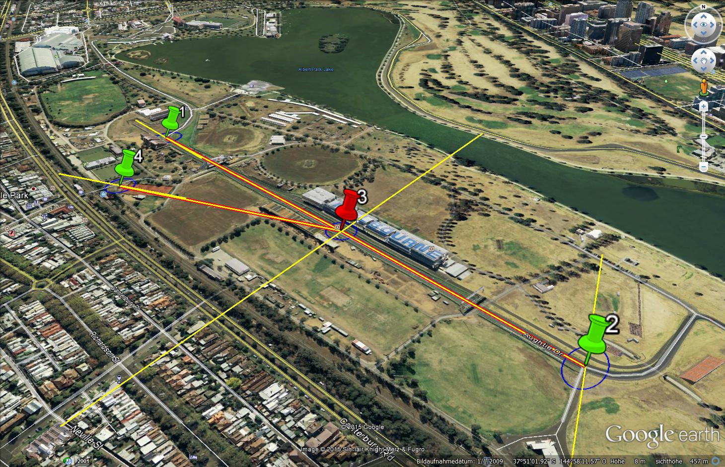
Free Station with 3 known points (back sights):
- 1 new point (station) with unknown coordinates are marked in red (point 3).
- Existing points with known coordinates are marked in green (points 1, 2 and 4).
- Station on point 3 with observations (orange lines) to point 2, 3 and 4
Example Free Station with 2 back sights
Accuracy (blue error ellipse in map):
Standard deviation is 3.5 mm. (notice that standard deviation of known points is set to 5 mm)
Reliability:
The report shows that the coordinates of point number 3 are not reliable. A false observation from station or a false coordinate of the reference points can cause an infinite wrong position of point 3 (999999 = infinite)
Example Free Station with 3 back sights
Accuracy (blue error ellipse in map):
Standard deviation is 3 mm. There is not a very big improvement of accuracy if you are using 3 known points to set up your station.
Reliability (yellow lines):
The report shows that the coordinates of point number 3 are now reliable. A false observation from station to point number 2 can cause an wrong position of point 3 of 4 cm.
Thoughts
Hi I have computed a resection from 3 points with 2mm(X), 0.8mm(Y), 1.2mm(Z). The height of the computed points is perfect but as you can see in the highlighted image all of them are rotated. Any thoughts of how can I avoid these things to happen in the future or maybe which may be the possible source of errors in this case?. I had the resection points placed in 3 quadrants so the geometry was as good as it gets, the distances were about 40m for the first resection points, about 20m for the second one and about 28 for the third one. Thanks
However with only two backsights it is impossible to detect a false coordinate. This is the dangerous part of just 2 backsights and the main reason that it is often recommended that free station must have at least 3 backsights.
It does not matter what software is used to calculate this. I do not know dc-surveys-software. Thank you for this input. I will try that one
Greetings,
I am not seeing all the pieces to your puzzle. You reference calculated with BestNetwork.?
I would be interested in your response comparing what you have as a result and using several methods available in DC_Survey software. Try the free version download from
www.dc-survey-software.com
Let me know.
Marcus
[email protected]