- Community
- Community Blog
- Surveyor Community Blog
Following examples are calculated with BestTachySpot.
You may have experienced this before. You are defining a new station and all points with known coordinates are more or less in the same direction. Be careful in this situation.
The situation explained with an example:
Resection on point 1 with observations to known backsight points on the road north of the site (green in following figure). Goal is to find the coordinates of point 5.
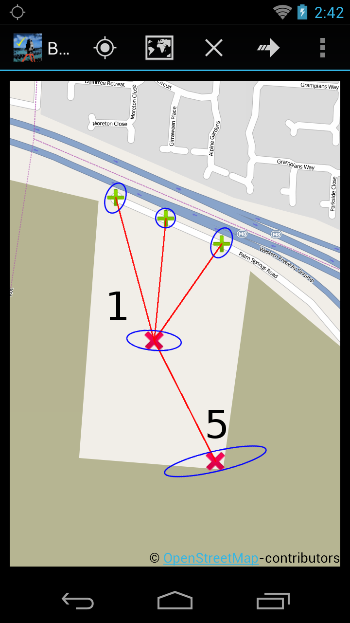

Accuracy (blue error ellipse in map):
Standard deviation is very bad 107 mm.
A bigger angle between the backsight points will help achieve a better accuracy of the coordinates of point 5. Thus, if possible, use different known points to improve your results – as shown in the following example.
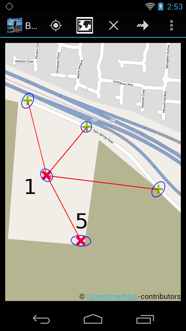

Accuracy (blue error ellipse in map):
Standard deviation is considerable improved (37mm compared to 107mm before) through the use of backsight points with a larger angle between them(notice that standard deviation of known points is set to 35mm)
Check your resection with BestTachySpot.
Thoughts
this is very helpful.. thank you for sharing it with us!