All Posts (15)

Sort by
Party Chief
Hello Surveyors!
You have most likely noticed that everyone's profile has a "Gift" application at the top by default and wondered to yourself "What the heck is that?"

1198843065?profile=original
Maybe you thought it was dumb and just continued about your business-perhaps you gave it a whirl. Don't give up so easy-there is actually a good reason for giving gifts. What i am here to tell you about may be of great interest to any of you who are interested in building lasting relationships with other land surveyors on LSU. W
Read more…
Party Chief
In this post, I will give you some valuable resources and links to International surveying companies and some well know land surveying associations, in hopes that readers will add any links that I might have missed in the comments below. This will be PART THREE of my series of Surveying Resources
Read more…
Party Chief

UPDATED: Ā You can now find theĀ Surveyors Handbook Here in Resources

This is PART TWO in the Surveying Resources and Links Series [part 1 here], which is all about online land surveying publications, links and industry blogs. There is a chance that something on this list could become extremely helpful to you some day so feel free to bookmark and/or share this list with your land surveying buddies. If there is something you'd like to add or a link that I missed, feel free to drop it below with a

Read more…

help with Civil 3D and importing Lat and Long points

I need help. Can any one guide me on importing points collected from a GPS unit.What format should my Excel file be in or should I use a .txt file? Right now my Excel file is a .CSV and it only has 3 columns: point number, latitude, longitude looks like: 2 45.33353745 -122.7635515Also how to set up the import Point File format in Civil 3D?What should the drawing settings be as far as the zone and available coordinate system?Thanks
Read more…
Party Chief
I just ran across an article on Mashable about the first astronauts to send a twitter update from outer space and it got me to thinking more about our Field Support Group here on LSU. I've come to the conclusion that If Astronauts Can Tweet from Space, Surveyors Can Tweet from the Woods! If you are interested in becoming part of this experimental group which I have been masterminding, which will enable networked land surveyors to use Twitter and Google Wave to assist one another with real-time t
Read more…
Party Chief
This is part One of a series of blog posts regarding land surveying resources and links for our LSU members-this one is all about land surveying schools and certifications. If you have a resource or link that I missed, please feel free to drop it in the comments below the post so that everyone may benefit from this resource. LAND SURVEYING SCHOOLS, COLLEGES AND TRAINING http://www.cinstate.cc.oh.us Cincinnati State Technical & Community College - Engineering Technologies http://www.etsu.edu/scit
Read more…
GEO Ambassador
Below you will find a few pieces of software that I've run across and thought could be helpful to our land surveying members. They're all free! Comment if you have any questions whatsoever.mapinfo.JPG
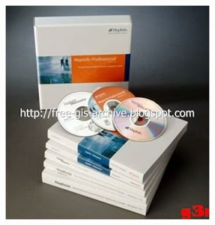
MapInfo Professional 10 FULLMapinfo Professional 10 Full | Mirror MediafireMapInfo Professional is a powerful Microsoft Windows-based mapping and geographic analysis application from the experts in location intelligence. Designed to easily visualize the relationships between data and geography, MapInfo Profess
Read more…

A Couple of GPS Hacks via Software

Here are a couple of GPS hacks that I ran across via and thought might be useful if not just interesting to the group. The first is a location based browser plug-in called Geode, by Mozilla. Geode will let users to take advantage of location data embedded within a web page. Geode’s uses Skyhook’s Loki technology, which determines position base on what WiFi access points it sees just like the Eye-Fi.

Geode

Download & Try It OutYou can download Geode here.The second comes from Hackaday as well. Its calle
Read more…
Popular Mechanics has a detailed how-to on diy ruggedization of common portable electronics such as laptops, cameras, and cellphones. There is video of a laptop surviving an eight foot fall due to the tennis balls, pipe insulation, and weather stripping they’ve added. Its not just shock resistant, they’ve used a two-part compound marketed for making custom molded earplugs to make the laptop water resistant.

rugged laptop

[via source]
Read more…

Annoying zoom extents?

In AutoCAD 2000i LDD when double clicking the mouse too quickly the drawing does a zoom extents. For example I have a three-button mouse, the center button (the mouse wheel) being the culprit, it controls the zooming and panning. Well I will be flying around in the drawing, zoomed in to some degree and then it happens; zoom extents!I think I found a fix to this problem by typing in at the command prompt: "viewres" and hit enter, you are then prompted with the question "Do you want fast zooms?" b
Read more…
Views: 114
Thoughts: 1
GEO Ambassador
Greetings Surveyors,Today I introduce to you our newest member of the LSU Network, Land Surveyor United (Admin), Justin Farrow. Justin is the creator and founder of LSU and has decided to make his profile the exclusive go-to for any questions, concerns, suggestions etc. regarding the network. I ask that ALL MEMBERS please go to this new LSU (Admin) profile and click on the "Add as Friend" link under his profile image.There are a lot of exciting changes about to occur with LSU, including an offic
Read more…

Log into community to no longer see ads

Land Surveying Guides

Our Blog Sitemap


Explore Surveying Locally

USA Surveying Forums
Asia Surveying Forums
Africa Surveying Forums
Middle East Surveying Forums
European Surveying Forums
South American Surveying Forums
Oceania Surveying Forums
Surveying Equipment Support Forums
Search Survey Photos
Add Posts, Surveying Photos, Videos and Articles to the Surveyor Community
Add Stuff to Community


Latest in Surveyor Community

Episode 276 - ASPRS Gulf South Region via GeoRadio- All Land Surveyor Podcasts in One

In this episode of The Geoholics, we go full geospatial nerd mode with several leaders from the American Society for Photogrammetry and Remote Sensing (ASPRS) — a professional organization that’s been shaping the mapping and imaging sciences…

yesterday
EP224 Milad Sadegi - Survey Technician & LSAW YSN Chair via GeoRadio- All Land Surveyor Podcasts in One

It is assumed that most surveyors are either born into the profession or discover it during their formidable years of education. Sometime, however, a career change opens one's eye to finding the passionate role their life may have been missing.…

Wednesday
EP223 GeoWeek 2026 - NSPS Leadership Reflection via GeoRadio- All Land Surveyor Podcasts in One

This week's episode of "Surveyor Says! The NSPS Podcast" finds us in Denver, Colorado wrapping up a great opportunity of promoting our new state affiliate membership drive at GeoWeek 2026. Your host, Tim Burch, sat down with Linda Foster (NSPS…

Feb 25
Episode 273 - Brian Owens via GeoRadio- All Land Surveyor Podcasts in One

This week, the crew sit down with Brian Owens, VP of Safety & Team Development at Buesing Corp., author, songwriter, and a leader whose philosophy challenges the industry to rethink what safety really means. Drawing from a career spanning…

Feb 25
Week 164: Leadership Presentation on Changing Roles via GeoRadio- All Land Surveyor Podcasts in One
135 views 9 likes

Channel: Trent Keenan

Leadership Presentation on Changing Roles, Presentation by Gary Kent,…
Feb 25
EP222 Halff Prep Sessions w/ Amanda Jonas & Jib Ahmad via GeoRadio- All Land Surveyor Podcasts in One

Studying for your professional surveyor licensing test can be a daunting task, so this week's "surveyor Says! THe NSPS Podcast" is here to bring you much needed information. Your host, Tim Burch, caught up with Amanda Jonas, RPLS, and Jib Ahmad,…

Feb 18
Dondie Sotto,P.L.S,M.ASCE, MCIntsCES posted a discussion
Surveying is evolving fast with GNSS‑RTK, LiDAR, and automated digital workflows. I’m currently working on AI-driven agents to streamline field checks, coordinate validation, and data processing. What tasks do you think are most ready for AI…
Feb 16
Episode 272 - Mikel Bowman & Bowman Legacies via GeoRadio- All Land Surveyor Podcasts in One

This week on The Geoholics, we fire up the mics, and dive head-first into something bigger than business, bigger than titles… bigger than ego.

Legacy.

Our guest, Mikel Bowman — President of Bowman Legacies, leadership coach, keynote…

Feb 12
More…