Surveyors Online Toolbox will help you accomplish your online tasks with handy tools. In this group for conversion tools, sharing files and applications for the field.
Sync Your Phone Files Wirelessly
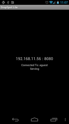
Developer's Description of Dropspot Lite
DropSpot is a minimalistic app that lets you easily access your Android phone's files using any modern web browser-- no wires needed. Just connect your computer to the same WiFi router that your phone is connected to, start the app, and go!
DropSpot's key feature is drag-and-drop, the source of its name. If you want to copy a file from your computer to your phone, all you have to do is drag-and-drop the file from your computer's file explorer onto your web browser. Want to move or copy a file within the phone? Drag-and-drop. It's simple and easy.
Please note that DropSpot is only compatible with modern browsers-- we recommend Chrome. This is the Lite version of DropSpot which I'm offering for free so you can make sure your browser is supported (of course, this could be a good opportunity to try a newer browser).
This Lite version has all the same features as the full version and you can use it forever! The only limitation is that you can't upload files larger than 5MB. (I also reserve the right to add ads, but there are none for now.) If you like what you see and want to get rid of the limitations, check out the full version of DropSpot!
If you encounter any errors, please let me know! I use this app myself, so I want it to work well just as much as you. If you need any help using it, check out the Wiki from the Homepage link, or here: https://bitbucket.org/dhleong/dropspot/wiki/Home
Supercharge and Extend Your Wireless Data Plan
Sometimes a carrier's internet data plan just isn't sufficient for a surveyor's needs. That's where Onavo Extend comes in.

**If you have installed a custom ROM, please read the instructions at the bottom of our App description**
√ Get as much as 5X out of your Android’s data plan
√ Traveling? Save up to 80% when roaming
Onavo Extend lets you get more out of your data plan, so you can do more web browsing and apps, consume more music, video and photos on 3G without breaking your data cap.
After you install Onavo Extend you can go back to using your phone or tablet as before. In the background, data usage from all apps and web browsing is compressed so that you do more with your Android’s mobile data month after month. And, if you travel abroad with your phone, the money you save could be substantial.
OS note: Onavo Extend is only supported for specific ICS devices.
"This is a necessity download for any smartphone user" - Gizmodo
"It's clever [..] you could save yourself a lot of cash!" - BBC
"This app doubles your data plan" - WSJ.com
IF YOU'VE INSTALLED A CUSTOM ROM:
Some ROMs and kernels are missing important networking support that Android 4.0 APIs, and Onavo Extend, rely on.
If you've received a message saying your version of Android is unsupported, or if the application always says "service paused", please contact us via the "Feedback" menu item so we can help.
Trying a different ROM or kernel should help as well.
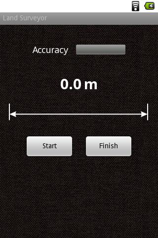
Measuring Distances Between Buildings
Land Surveyor is an app which is designed to assist with simple measurement tasks.
 Developer's Description:
Have you ever wanted to know the distance between buildings, or to measure the approximate length of the back yard?
Land Surveyor is a simple tool for measuring the distance between two points using a GPS receiver on your phone.
To measure:
Wait for green light of the GPS signal indicator (Accuracy) and press "Start" at the first point. Move to the second point and tap "Finish" button.
Note: accuracy is not guaranteed and may vary depending on your location and device. Do not use this tool for precise measurements.
You need to be a member of Land Surveyors United - Surveying Education Community to add thoughts!
Replies
111 views and no comments on this...amazing