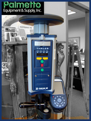
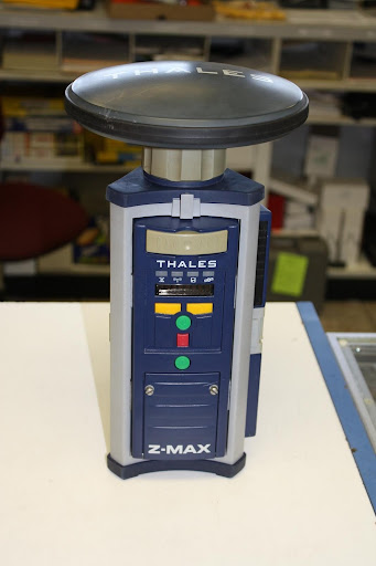
Z-Max.Net is the next-generation survey solution from Magellan. The .Net generation offers NTRIP, GPRS and RTCM V3.0 network communication. We happen to have a couple of really affordable Zmax units available in the Land Surveyors United Store. The following information is a support guide for the Zmax from Magellan.
Free Yourself from Operational Constraints!
Network Generation
Z-Max.Net delivers high accuracy and enhanced performance for all your survey needs.
Survey Your Way
The ultra-flexible Z-Max.Net survey system lets you control your survey your way. Whichever configuration you chose, Z-Max.Net adapts to your survey environment and delivers the best performance. Z-Max.Net frees you from typical equipment limitations and keeps you ahead of the industry.
Z-Max.Net is ready to support today's requirements and tomorrow's:
- Survey in NTRIP, VRS or FKP networks.
- Select your communication mode: UHF, GSM/GPRS, unique combined UHF+GSM/GPRS module or external source.
- Switch seamlessly from post-processing to RTK.
- Use ZMax.Net as a base or rover.
You can perform any GPS survey with Z-Max.Net.
 Survey with Added Freedom
The innovative design offers comfort and ease-of-use. Detachable modules make configuration changes and system upgrades simple.
Use the intuitive keyboard or Bluetooth® wireless field terminal to perform any survey with added freedom. Configure your Z-Max.Net "all-on-the-pole" or in the comfortable backpack for long-duration missions.
The modular design and flexibility makes upgrades easy and cost-efficient, protecting your investment and ensuring a high return.
Get the Max Out of Your GPS
Z-Max.Net delivers the strongest RTK on the market. A combination of unique technologies from Thales enables you to optimize your time and maximize your profit. Z-Max.Net offers two-second initialization, extended operation up to 50 km (30 miles) and cuts static data collection time by up to 50%.
- Patented Z-Tracking and advanced multipath mitigation technologies ensure the strongest centimeter-level position even in weak signal conditions.
- Instant-RTK® technology enhances survey productivity by offering two-second initialization: The fastest on the market.
- Magellans' unique LRK®, long range kinematic technology, combines fast, real-time centimeter-level positioning up to 50 km (30 miles).
- State-of-the-art Prism technology cuts data collection time by as much as 50% for post-processed surveys.
Powered by state of the art technologies, Z-Max.Net ensures exceptional RTK coverage and data confidence even in difficult environments.
The Complete Solution
Z-Max.Net enhances your surveying capabilities, improves your data quality and upgrades your deliverables with a comprehensive suite of software tools:
- FAST Survey field software simplifies data collection and real-time operation.
- GNSS Solutions office software provides powerful support to a wide range of applications, handling both real-time and post-processing data within the same project.
Z-Max.Net offers the best, at the office and in the field, with robust office software and fully integrated, state-of-the-art data controllers. Z-Max.Net offers two high-quality field terminals: the MobileMapperTM CE from Magellan and the classic AllegroTM from Juniper Systems Inc.®
Features include color touch screen, SD-card, USB and Bluetooth® wireless technology, ensure a robust, easy-to-use, cable-free RTK rover.
Combined with MobileMapper CE, Z-Max.Net becomes the only survey system on the market to include an additional handheld GPS for multiple application needs (GIS, navigation, and more). Only Z-Max.Net can offer that kind of advantage.
As a Z-Max.Net surveyor you are prepared for any job condition and ready to meet your customers' needs. Quality, productivity, ease-of-use, cost-efficiency and profitability: Z-Max.Net delivers it all.
Can I use Z-Max RTK receiver with other GPS products?
Z-Max is designed to be compatible with industry standard RTCM type correction data. Z-Max RTK bases and rovers also support proprietary RTK formats such as DBEN and CMR. Z-Max rovers also support the LRK correction format output by DSNP brand products. Any professional quality dual-frequency correction data in a format supported by Z-Max should work (RTCM, CMR). RTK data from any Ashtech Z-family receiver will work. Base data provided by DSNP 6500 (Scorpio) receiver will also work.
How can I upgrade my Zmax System to Zmax.net?
All the new features are just one free firmware upload away! In line with its traditional policy of free upgrade, Magellan has placed the new firmware for free downloading on its ftp site. Contact your Local Dealer for more information. The new modem for operation in the 850 MHz band (North America mainly) requires a new communication module. Magellan offers a special upgrade path to its loyal customers. Contact your Local Dealer for more information. Z-Max.
How can I use ProMark3 along ProMark2 and/or Z-Max receivers?
Data collection for post-processing with ProMark2 or Z-Max? receiver as a base and ProMark3 as rover; or reverse In fact, ProMark3 is so flexible that it does not limit operation to Magellan GPS receivers. ProMark3 data can be processed with any data in RINEX format. However, you will only get the best of your ProMark3 system and the Prism technology when using two (or more) ProMark3 units and the appropriate office software, GNSS Solutions.
 Do I need to do anything special to the data card before using it in the Z-Max?
Before the initial use, the SD Card should be formatted. The SD Card format task can be performed by the $PASHS, CLM command via the Ashtech Evaluate software, or the GNSS Studio ? Win Comm utility. Alternatively, the SD-Card can be re-formatted inside the Z-Max receivers SD Card slot. Press and hold the Power key for five-seconds. After five-seconds, the phrase "re-init" will be displayed on the front panel until the initialization is complete.
How do I transfer data files from the Z-Max data card to My PC?
A:There are several ways to download data from the SD Card to the PC for processing. The most convenient methods are to download data directly from the SD Card, download data via the USB port, or via the Rear Panel Serial I/O ports using the Download Utility from GNSS Studio. Method 1: Data Transfer via an SD-Card Reader, CAUTION: It is important to power off the receiver using the Power key on the Front Panel before removing the SD Card.
How do I use an external GPS antenna with Z-Max?
The Max-RF adapter (part number 800978) is attached to the top of the Z-Max and provides a "TNC type" GPS RF connector. A cable can then be used with an external GPS antenna. Some manufacturers' GPS antennas are not compatible with Z-Max, so call Magellan to verify if a non-Magellan GPS antenna will work.
How do I use the OPUS (USA only) processing system with Z-Max data?
Magellan has prepared a workflow using Ashtech GPS receivers for collecting Dual-Frequency GPS data, downloading and converting the B and E-Files into the RINEX format for submission to the NGS OPUS service. This workflow can be downloaded from the Magellan Support Site: ftp.thalesnavigation.com/Training/OPUS
What data collectors will work with Z-Max?
The FAST Terminal sold by Magellan has been fully tested with the Z-Max system. Magellan will provide support and service for data collectors it sells. Other data collectors may be compatible with Z-Max to varying degrees but are not warranted nor guaranteed.
Remember: Zmax demo units available for affordable prices on Land Surveyors United Store
Replies
I need update files for zmax
[email protected]
Find helpful resources for the ZMax on the ftp server at
ftp.ashtech.com
Phil