I wonder what magnitude of vibration my Leica Flexline can effectively handle. I am hesitant to allow my total station in such a type of work environment. I have a feeling that extreme high vibration due to heavy machinery can break my total
I bought a used SDR33 Expert 4MB. When I tried using it for Topographic survey, backsight residual report is always to the tune of more than 5 minutes. I am not comfortable with it. Did I miss something?
I am wondering how tilt compensator really works. Is it relative to the current plumbline or to the initial plumb line? I am asking this simply because anxiety is really there when my TS tilts over point occupation time. This is a reality that we can
What is the rule of thumb employed in differential correction process? Is it for one-to-one correspondence among the receivers pertaining to satellite availability? Meaning, if tracked satellite A in rover is not in base satellite list then it is off
Is anybody knowlegeable enough regarding the Pacific Crest PDL HPB power specification? The power cable is equipped with a 3A automotive fuse. I switched the RF Power Switch from Low to High while the radio was on. Result was a busted fuse. Unfortuna
I am looking for a good battery operated hand drill that can get through concrete pavement with ease. This speeds up the installation of magnetic survey marker nails on hard concrete pavement. Any idea? Thank you.
I am looking for a methodology on how to effectively determine a total station's standard deviations. I need those specific values for my Least Squares analysis. Relying on values supplied by the manufacturers is unfortunately too generic according t
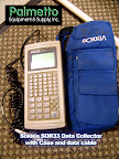
I have an old SDR33 Expert data collector with only 2,000 points storage capacity. I wish I can upgrade the storage capacity to a one-week workload of maybe 2MB. Anybody out there have any idea on how to do it? Thank you very much.
GPS L1/L2 position fixing incapability under heavy foliage is a thing of the past with the advent of GPS L5. This is according to GNSS sales people. With my very limited knowledge in telecommunication, I shall say without any degree of certainty that
I prefer via survey observation values via FBK as it is raw. I find civil 3D data reduction tool an extremely effective utility. All my survey data are imported like as follows:
I am wondering if there commercially exists a Digital Point Description Collector. Modern Data Collector is too complicated to learn for a high school grad. Dealing with figure field codes, all the COGO routines, and all the inverse functions are not
I am supposedly posting this discussion in Leica and Microsurvey Groups but I guess this is applicable to all brands. My experience is that my data collector does not support spooling technique. Taking Leica into consideration and Fieldgenius 2010, s
From a surveyor's standpoint, it is very strange to learn that as one of the leading civil/survey/mapping package, Autodesk Civil 3D FBK does not support resection command. There is no command entry for Resection. It was confirmed by James Wedding fr
 I wonder how to edit reflector height value in SDR33 database. I went through the system but I found nothing. Did I miss something?